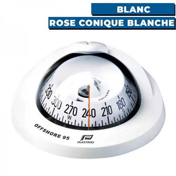
The magnetic compass is the default instrument on sailboats. Unlike commercial vessels, which generally have a gyrocompass, it is usually the only instrument on board that points to the (magnetic) north. Regardless of the vessel type, Canadian regulation requires a magnetic compass onboard (on vessels of more than 8 meters).
The aim of this text is to show how to construct your compass’s deviation table based on readings of the cardinal points (North, South, East, West) and intercardinal points (NE, SE, NW, SW) on your compass. You need to understand trigonometric functions, as well as the ability to plot graphs. This guide also assumes you are familiar with the difference between magnetic north and true north, as well as with declination (or variation) and deviation. If you are unfamiliar with these concepts, taking a coastal navigation course is a prerequisite.
The formula
Let d be the deviation and Cc be the compass bearing of your sailboat. Any deviation table can be expressed by the relationship:
where A, B, C, D and E are unknown coefficients relating your sailboat’s magnetism with respect to Earth’s magnetic field. To determine these coefficients, follow the procedure below.
The procedure
- Using your sailboat, take a reading from its compass at the true cardinal points and true intercardinal points (North, North-East, East, South-East, South, South-West, West, North-West). This requires you to be able to identify these points without using your compass. This can be done, for example, by:
- In the absence of winds and currents, using a GPS that displays the course over the ground.
- Using a handheld compass, finding the readings positioned in a location where there is no ferromagnetic interference (accounting for variation, of course).
- By identifying landmarks that points the proper direction at a given location (or using a pelorus with one single landmark).
- Calculate the magnetic declination at your current location and deduce the compass deviation using the chosen method:
- Using a GPS: calculate the magnetic cardinal points by adding the deviation (+ if West, – if East), and calculate the difference between the values obtained from your compass and the calculated values. This gives you the deviation (+ if West, – if East).
- Calculate the difference between the readings from your compass and those from your handheld compass; this will give you your compass deviation (+ if West, – if East).
- Using landmarks: calculate the magnetic cardinal points by adding the deviation (+ if West, – if East). Then calculate the difference between the readings from your compass and the calculated values. This gives you the deviation (+ if west, – if east).
- You will then have a table containing 8 deviations.
- Using the 8 deviations obtained, calculate the coefficients A, B, C, D and E with the formulas below.
- Your compass deviation is then represented by the mathematical expression at the start of this text.
The five formulas
An example
By applying the recipe above, you have obtained the following deviations for the compass of your sailboat:
| True bearing | Deviation (di) |
| N | -9.0 |
| NE | 2.7 |
| E | 4.0 |
| SE | 5.4 |
| S | 9.0 |
| SW | 1.3 |
| W | -16.0 |
| NW | -21.4 |
What is your compass’s deviation table?
Solution
We need to identify the coefficients A, B, C, D and E:
(Here, the values in the table are such that the formulas yield neat whole numbers, so as to aid understanding the calculations. In practice, the calculated numbers will have decimal places.)
The equation giving the deviation table is therefore:
The graph is therefore plotted as follows:
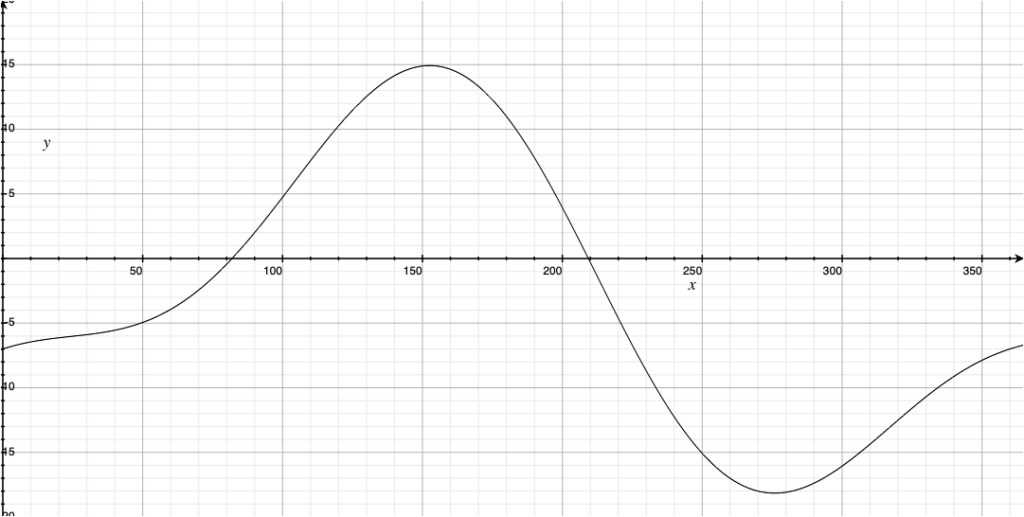
The y-axis represents the deviation (+ West if , East if -) and the x-axis represents the compass bearing. We can then read the graph (or solve the equation!) to find the compass deviation for any bearing.
Once the coefficients calculated, it is possible to use an online plotter to draw the curve.
Conclusion
Following the recipe allows to find a compass’ deviation table. In practice, deviations should not be as big as in the example (a deviation near -18° in the worst case!), but closer to the -5° to 5° range. Moreover, the term A should be very close to zero. Otherwise, this might be an indication that your compass needs to be re-calibrated.