This text explains a fixing technique that is applicable on fast boats. It makes use of paper charts when there is little to no space for chartwork. The technique is useful if the chartplotter fails, or if checking the validity of an electronic fix is required.
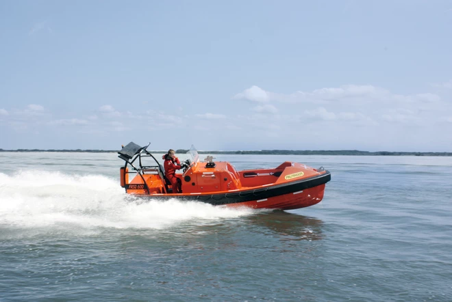
I learned the technique while reading the book Coastal and Offshore navigation. The technique is fairly useful on small and fast boats, such as a powerboat or a fast craft with an inflatable rib (e.g. zodiac). It is simple and fast, but it requires planning.
The Traditional Fixing Technique
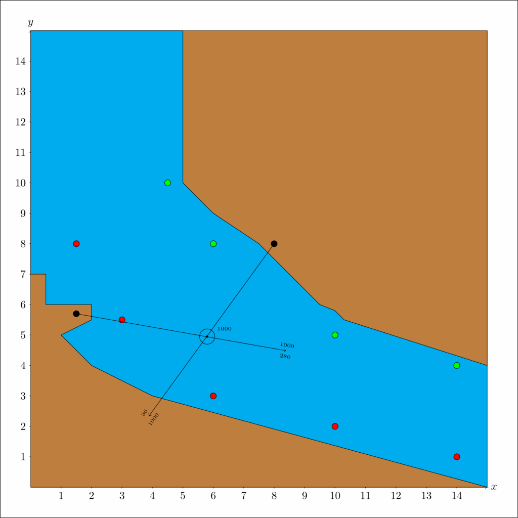
The traditional fixing technique works by finding the bearing of (at least) two landmarks and then identifying the position of the boat at the intersection of the two lines of position. An example is illustrated in the pseudo-chart below with the Sail Canada uniform annotation convention. The time of the fix is 1000 and the two landmarks are represented by black circles. At the time of the fix, one is seen at 036° (True) and the other at 280° (True).
There are at least two problems with the traditionnal fixing approach. First, it requires a chart table large enough to work with parallel rules and a protractor, or a breton plotter. Second, the boat’s speed, in relation to the navigator’s ability to plot, must be slow enough to perform the fix in a reasonable time. On some boats, these two problems render the technique useless. With a bit of planning, one can however use the same idea with little to no plotting while underway.
The Fast Fixing Technique
The idea is to chart in advance the possible compass bearings of the landmarks, so as to constitute a grid of the possible fixes. It is shown in the image below. How close should each bearing be drawn depends on the chart and the proximity of the landmarks. Below, they are spaced by four degrees, but a different context may warrant more or less spacing.
The grid must be done in advance, at the time of passage planning, and the best practice is to label each bearing with its compass (or magnetic) value. That way, the correspondance between the compass reading and the appropriate line can be done instantly while underway.
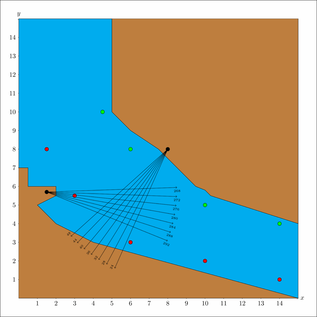
The fastest way to perform the fix is to align the boat with the landmark that makes the most sense given the circumstances. This gives the landmark’s bearing by just looking at the boat’s compass. At the same time, a second person reads the bearing of the second landmark with a handheld compass. Since the mapping is already done on the chart, all that is needed to do the fix is to circle one pre-drawn intersection (image below).
It is fast and it requires no drawing while underway. Alleviating the need to draw when the boat is rocking and going full speed is not only practical, but invaluable.

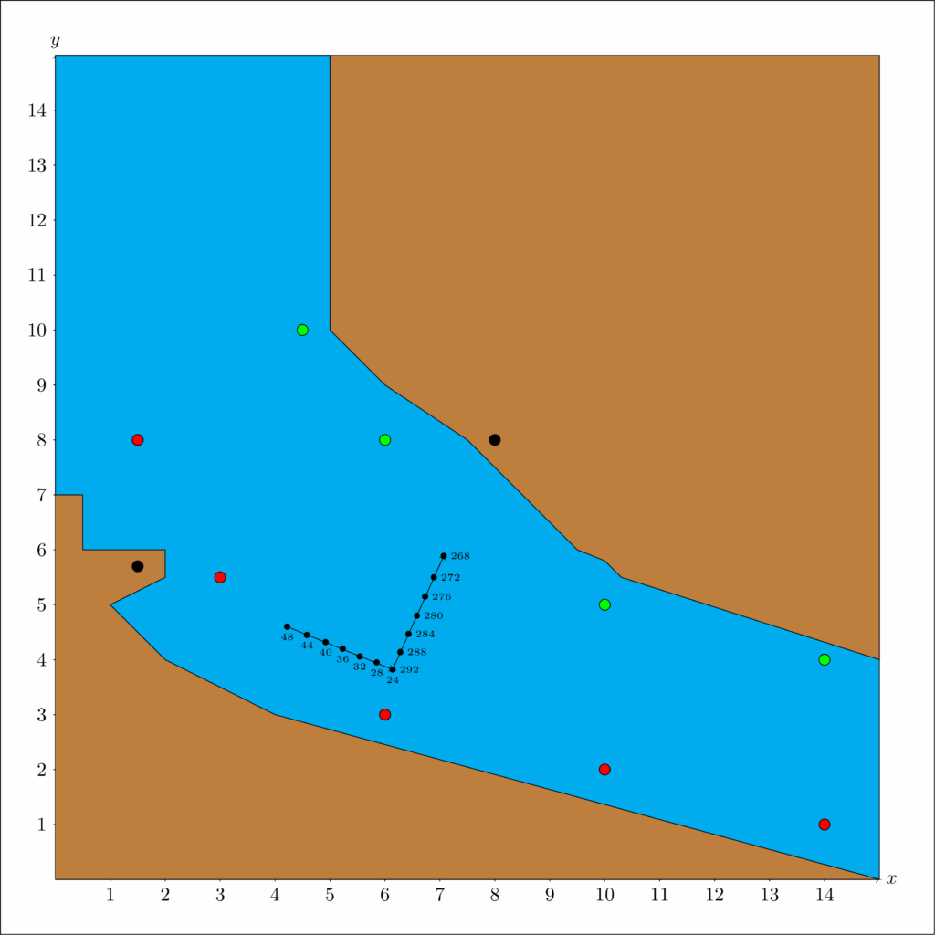
Most grids for fast fixing will be on a relatively small portion of the sailing area. As such, the impact of the fix on the course to steer to the next waypoint should be negligible. However, if that is not the case, one can also build a pre-established table of course to steer as a function of the circled position. The table below shows an example coherent with a waypoint at roughly the coordinate (15, 2) on the pseudo-chart.
With such table, there is no need to compute or measure the corrected course on the fly. In fact, you don’t even need to draw anything on the chart. All you need is to read the table to deduce your corrected course. Again, highly practical when there is no chart table!
| CTS | 268 C | 272 C | 276 C | 280 C | 284 C | 288 C | 292 C |
| 048 C | 113 C | 113 C | 111 C | 110 C | 109 C | 108 C | 108 C |
| 044 C | 115 C | 114 C | 112 C | 111 C | 109 C | 108 C | 108 C |
| 040 C | 115 C | 115 C | 112 C | 112 C | 109 C | 108 C | 107 C |
| 036 C | 116 C | 115 C | 113 C | 112 C | 109 C | 108 C | 107 C |
| 032 C | 117 C | 116 C | 113 C | 112 C | 109 C | 108 C | 107 C |
| 028 C | 118 C | 117 C | 114 C | 112 C | 110 C | 108 C | 107 C |
| 024 C | 119 C | 117 C | 114 C | 112 C | 110 C | 108 C | 107 C |
Fast Fixing With A Radar
The same technique can be applied with a radar and a single landmark. It inherits the same advantages, with the additional bonus that there is no need to turn the boat to align the compass with the landmark. Conceptually, the biggest adaptation is to draw (arcs of) circles of distance in advance (image below). The resulting grid will have a different look, but the same « no drawing, just circling » logic applies. All that is needed is a bit of chartwork preparation.

Fast Fixing With Multiple Passages
One drawback of the illustrated technique is to clutter the chart with a grid. It works well when there are only two landmarks used. When more than two are used, plotting a grid becomes an unreadable mess. Moreover, if two relatively close fixes are needed, but use different landmarks, the same problem arises. It is then best not to draw the grid in its entirety, but to only draw its edges (image below). The result keeps the chart cleaner, but requires to draw the bearings with a ruler. It is still easier than the traditional fix and it may be the best option in a busy area of the chart.
Conclusion
On fast crafts with little place for chartwork, the fast fixing technique is hard to beat. It requires no drawing and very little time to execute. However, it comes at the cost of planning. If for some reason one must go out of a pre-established route, then re-calculating the route – or slowing down – will be required. Or perhaps the chartplotter will provide sufficient accuracy.